2003 Milwaukee, Wi Vicinity (City Wall Maps)
Price 159.50 USD
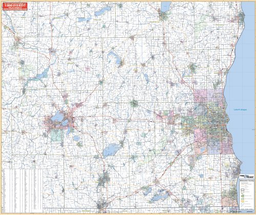
The 2003, 1st edition Wall Map of Milwaukee, Wisconsin and the surrounding 14 counties measures 64 x 54 and provides up-to-date cartography at a scale of 1 = 10,032 feet, or 1.9 miles. Printed in color with a markable and washable laminated surface. Cities are indexed on the face of the map. Includes hanging rails that are mounted on top and bottom. Coverage includes the counties of Columbia, Dane, Dodge, Fond du Lac, Kenosha, Jefferson, Milwaukee, Ozaukee, Racine, Rock, Sheboygan, Walworth, Waukesha, and Washington. Boundaries: North: 55 miles north to Sheboygan and Fond du Lac; South: 40 miles south to the state line; East: to Lake Michigan; West: 100 miles west to the city of Madison and all of Dane County. Details include major streets and all highways, county lines and names, mileage circles, ZIP codes and boundaries, airports and parks, water features, and longitude/latitude lines. Railed wall maps can be turned into pull down maps on spring rollers for an additional $30.