Trimble Outdoors West Virginia Off-The-Grid Maps (GPS Topo Maps with Public and Private Land Ownership Borders for Smartphones and Tablets)
Price 90.10 USD
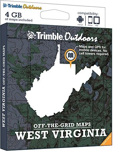
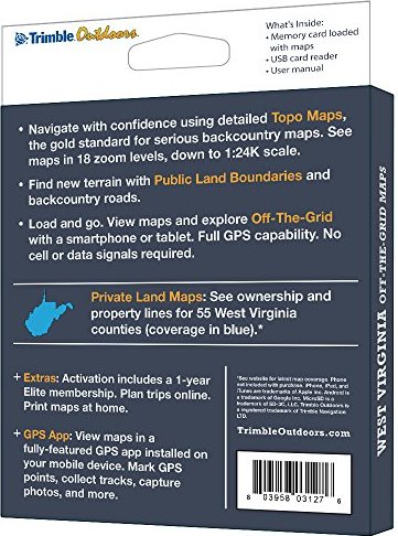
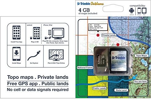
Turn your iPhone, iPad, or Android into a fully featured GPS with West Virginia Off-The-Grid Maps. Get instant access to thousands of full-color topo maps for the entire state. These offline digital maps work off-the-grid, even when you"re far from cell phone and data networks.Includes GPS mobile apps designed for hiking, backpacking, hunting, and other outdoor activities.• Map Types Included: Topographic, Forest Roads, Lake Maps, Public Land Boundaries, Private Land Maps• Every memory card comes pre-loaded with an entire state"s worth of full-color USGS topo maps, enhanced by MyTopo.• Topo maps feature 18 zoom levels (1:250K to 1:24K) so you can see your GPS location in great detail. See 20-foot contours in most places.• Private Land Maps: See ownership and property lines for these West Virginia counties: Barbour, Berkeley, Boone, Braxton, Brooke, Cabell, Calhoun, Clay, Doddridge, Fayette, Gilmer, Grant, Greenbrier, Hampshire, Hancock, Hardy, Harrison, Jackson, Jefferson, Kanawha, Lewis, Lincoln, Logan, Marion, Marshall, Mason, Mcdowell, Mercer, Mineral, Mingo, Monongalia, Monroe, Morgan, Nicholas, Ohio, Pendleton, Pleasants, Pocahontas, Preston, Putnam, Raleigh, Randolph, Ritchie, Roane, Summers, Taylor, Tucker, Tyler, Upshur, Wayne, Webster, Wetzel, Wirt, Wood, and Wyoming.• Maps work off-the-grid. No cell towers required.• Works with iPhone, iPad, and Android devices. Android: Place microSD card into device. iPhone/iPad: Drag files from SD card into iTunes. Sync device.• Supported App: Trimble Outdoors (iPhone, Android, iPad). • Supported Website: TrimbleOutdoors.com.