Collins Mapstart 1
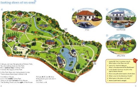
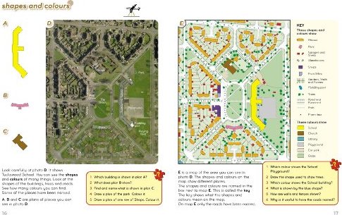

This structured map skills course uses a simple colourful layout to introduce young pupils to using and drawing maps and plans. Mapstart 1 is a structured introduction to map work for 6-7 year olds. It assumes no previous experience of map skills and establishes a sound foundation for graphic concepts, skills and vocabulary at a very simple level. Mapstart 1 has been designed with the following purposes in mind: * to build children"s spatial awareness through the use of familiar objects, toys, the locality of the school and space photos; * to extend children"s understanding and use of vocabulary associated with spatial location, organisation and movement; * to provide continuity through the book by the use of vertical aerial photos; * to introduce children to the perspective of plans and maps and to the representational characteristics of maps; * to encourage children to observe features and relationships in oblique and vertical photos and maps; * to foster children"s appreciation of the Earth as a globe. A free file of answers to questions in Mapstart 1 is available free to download at http://resources.collins.co.uk/free/Mapstart1Answers.pdf