Trimble Outdoors Ohio Off-The-Grid Maps
Price 88.83 USD
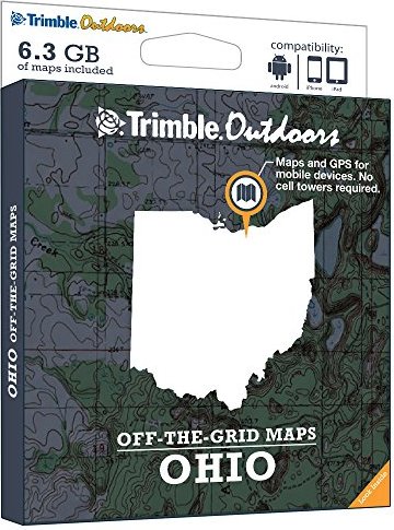
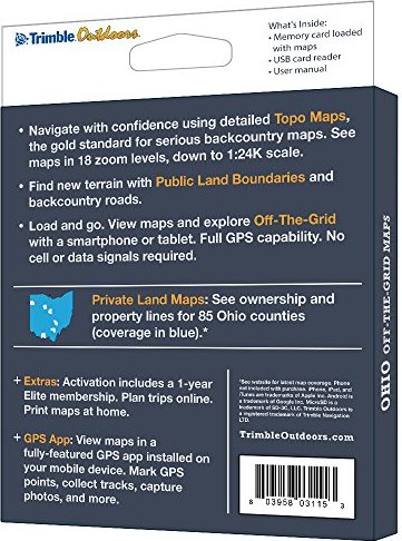
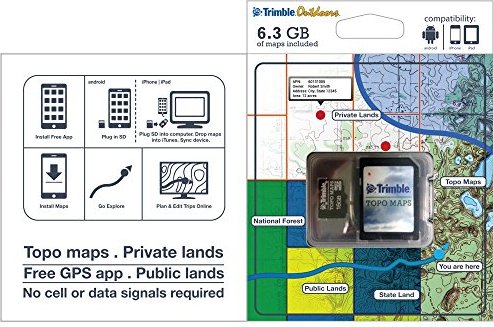
Turn your iPhone, iPad, or Android into a fully featured GPS with Ohio Off-The-Grid Maps. Get instant access to thousands of full-color topo maps for the entire state. These offline digital maps work off-the-grid, even when you"re far from cell phone and data networks.Includes GPS mobile apps designed for hiking, backpacking, hunting, and other outdoor activities.• Map Types Included: Topographic, Forest Roads, Lake Maps, Public Land Boundaries, Private Land Maps• Every memory card comes pre-loaded with an entire state"s worth of full-color USGS topo maps, enhanced by MyTopo.• Topo maps feature 18 zoom levels (1:250K to 1:24K) so you can see your GPS location in great detail. See 20-foot contours in most places.• Private Land Maps: See ownership and property lines for these Ohio counties: Adams, Allen, Ashland, Ashtabula, Athens, Auglaize, Belmont, Brown, Butler, Carroll, Champaign, Clark, Clermont, Clinton, Columbiana, Coshocton, Crawford, Cuyahoga, Darke, Defiance, Delaware, Erie, Fairfield, Fayette, Franklin, Fulton, Gallia, Geauga, Greene, Guernsey, Hamilton, Hancock, Hardin, Harrison, Henry, Highland, Hocking, Holmes, Huron, Jackson, Jefferson, Knox, Lake, Lawrence, Licking, Logan, Lorain, Lucas, Madison, Mahoning, Marion, Medina, Meigs, Mercer, Miami, Monroe, Montgomery, Morgan, Morrow, Muskingum, Noble, Ottawa, Paulding, Pickaway, Pike, Portage, Preble, Putnam, Richland, Ross, Sandusky, Scioto, Seneca, Shelby, Stark, Summit, Trumbull, Tuscarawas, Union, Van Wert, Warren, Washington, Wayne, Williams, and Wood.• Maps work off-the-grid. No cell towers required.• Works with iPhone, iPad, and Android devices. Android: Place microSD card into device. iPhone/iPad: Drag files from SD card into iTunes. Sync device.• Supported App: Trimble Outdoors (iPhone, Android, iPad). • Supported Website: TrimbleOutdoors.com.