Trimble Outdoors Kentucky Off-The-Grid Maps
Price 93.08 USD
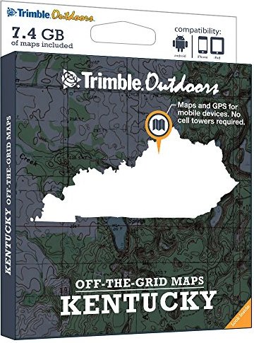
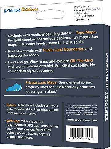
Turn your iPhone, iPad, or Android into a fully featured GPS with Kentucky Off-The-Grid Maps. Get instant access to full-color topo maps for the entire state. These offline digital maps work off-the-grid, even when you"re far from cell towers.Includes GPS mobile apps designed for hiking, backpacking, hunting, and other outdoor activities.• Map Types Included: Topographic, Forest Roads, Public Land Boundaries, Private Land Maps• Every memory card comes pre-loaded with an entire state"s worth of full-color USGS topo maps.• Topo maps feature 18 zoom levels (1:250K to 1:24K). See 20-foot contours in most places.• Private Land Maps: See ownership and property lines for these Kentucky counties: Adair, Allen, Anderson, Ballard, Barren, Bath, Boone, Bourbon, Boyd, Boyle, Bracken, Breathitt, Breckinridge, Bullitt, Butler, Caldwell, Calloway, Campbell, Carroll, Carter, Casey, Christian, Clark, Clay, Clinton, Crittenden, Daviess, Edmonson, Elliott, Estill, Fayette, Fleming, Floyd, Franklin, Gallatin, Garrard, Grant, Graves, Grayson, Green, Greenup, Hancock, Hardin, Harlan, Harrison, Hart, Henderson, Henry, Hickman, Hopkins, Jackson, Jefferson, Jessamine, Johnson, Kenton, Knott, Knox, Larue, Laurel, Lee, Leslie, Letcher, Lewis, Lincoln, Livingston, Logan, Lyon, Madison, Magoffin, Marion, Marshall, Martin, Mason, Mccracken, Mclean, Meade, Menifee, Mercer, Metcalfe, Monroe, Montgomery, Morgan, Muhlenberg, Nelson, Nicholas, Ohio, Oldham, Owen, Owsley, Pendleton, Powell, Robertson, Rockcastle, Rowan, Russell, Scott, Shelby, Simpson, Spencer, Taylor, Todd, Trigg, Trimble, Union, Warren, Washington, Wayne, Webster, Whitley, Wolfe, Woodford.• Maps work off-the-grid. No cell towers required.• Works with iPhone, iPad, and Android devices. Android: Place microSD card into device. iPhone/iPad: Drag files from SD card into iTunes. Sync device.• Supported App: Trimble Outdoors