Rhone/Alps, 14
Price 8.95 USD
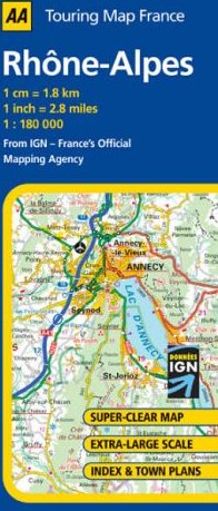
One of 16 maps in a regional series for France at 1:180,000 scale (1 inch = 2.8 miles). Map uses the accurate and beautiful IGN (French Mapping Agency) cartography and shows all levels of roads, railways, natural features, distance in kilometers and road numbers, tourist and historic sites, and department and regional boundaries. Includes index of placenames and many insets for cities and towns on the map.