Corsica [France] (National Geographic: Adventure Map)
Price 9.67 - 11.95 USD
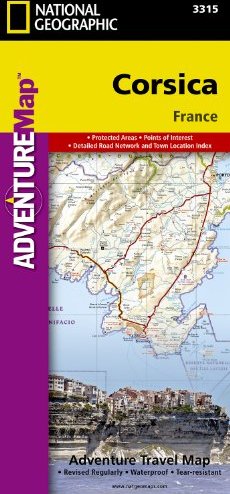


• Waterproof • Tear-Resistant • Travel Map National Geographic"s Corsica AdventureMap is designed to meet the unique needs of adventure travelers with its durability and accurate information. This folded map provides global travelers with the perfect combination of detail and perspective, highlighting hundreds of points of interest and the diverse and unique destinations within the country. The map includes the locations of cities and towns with a user-friendly index, plus a clearly marked road network complete with distances and designations for major highways, main roads, and tracks and trails for those seeking to explore more remote regions. The front side of the Corsica map details the northern region of this island country; bordering Golfe de Sagone and Golfe de Porto to the west, Tyrrhenian Sea to the east, and the Ligurian Sea and Golfe de St.-Florent to the north. The reverse side of the map details the southern region; from its border with the Bouches de Bonifacio to the south, to the Tyrrhenian Sea, Golfe de Santa-Manza and Golfe de Porto-Vecchio to the east, and the Mediterranean Sea, Golfe de Sagone, Golfe de Valinco and Golfe d" Ajaccio to the west. This island is located west of Italy, southeast of the French mainland and north of the Italian island of Sardinia. Every AdventureMap is printed on durable synthetic paper, making them waterproof, tear-resistant and tough — capable of withstanding the rigors of international travel. Each is two-sided and can be folded to a packable size of (4.25" x 9.25"); unfolded size is (26" x 38"). Key Features: - Waterproof and tear-resistant - Accurate topography/terrain with a clearly labeled road network - Hundreds of points of interest, including the locations parks and nature reserves, protected lands, historical and cultural attractions - Thousands of place names including towns and natural features; detailed place names index - Important travel networks including airports, lighthouses, ferry routes and rail lines - Updated regularly to ensure accuracy Proceeds from the sale of National Geographic maps go to support the National Geographic Society"s vital exploration, conservation, research and education programs.