The Florida Keys


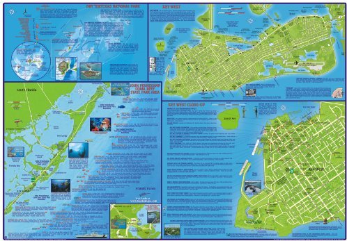
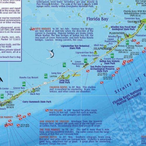
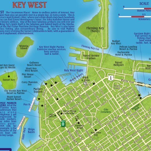
Florida Keys 1:100,000 / 345,000 Guide and Dive Map, waterproof FRANKO, 2011 edition This map is waterproof and tear-resistant, highly durable in tropical conditions of Florida Keys, double-sided to provide the best balance between a good scale and a convenient sheet size (size 66 x 47 cm / 26 x 18.5 in), with topographic and tourist information.This beautiful map describes and shows the locations of numerous points of interest in the Florida Keys, and also has descriptions and shows the locations of the numerous snorkeling and scuba diving sites. The Florida Keys is a tropical archipelago consisting of 1,700 islands beginning at the southeastern tip of the Florida peninsula, and arching south-southwest to Key West, the westernmost of the inhabited islands, and on to the uninhabited Dry Tortugas. Side One shows the whole island chain at scale 1:345,000 with Highway 1 running over islands and bridges from Key Largo to Key West. This side describes and shows the locations of numerous points of interest in the Florida Keys, and also has descriptions and shows the locations of the numerous snorkeling and scuba diving sites. The map beautified by a gallery of Caribbean Reef Creatures, with over 100 species depicted and named in both English and Spanish. Side Two shows the northern part of the Keys at scale 1:100,000, from Key Largo to Plantation Key. Included are close-ups of Key West detailed street plan (1 inch = 190 yds), the John Pennekamp State Park area, central Key Largo, and Dry Tortugas National Park.