Green Mountain National Forest South [Robert T. Stafford White Rocks National Recreation Area, Manchester] (National Geographic: Trails Illustrated ... Geographic Maps: Trails Illustrated)
Price 10.75 - 11.95 USD
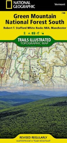
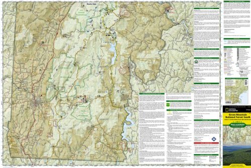
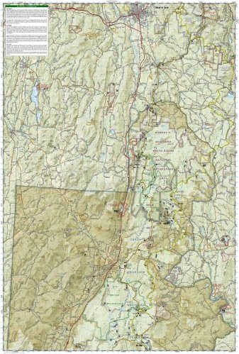
• Waterproof • Tear-Resistant • Topographic Map National Geographic"s Green Mountain National Forest South Trails Illustrated topographic map is the most comprehensive available for outdoor enthusiasts of all types. Designed to be easy-to-read, yet highly detailed – this map includes a comprehensive road and trail network distinguishing between major, secondary and 4x4 roads, hiking, horse, biking, multi-use and non-motorized winter trails. All forest roads are labeled with their official road number and trails are clearly identified with their given name. Land management boundaries are color-coded showing National Forest, Ranger District, Wilderness Areas, Conservation Areas and more, plus the locations of private land within the Green Mountain National Forest. The renowned Appalachian Trail, Catamount Trail, and Long Trails are highlighted on the map. An extensive collection of important and unique locations are pinpointed on the map including: visitor centers, campgrounds and backcountry shelters, picnic facilities, parking areas, RV dump sites, interpretive trails, boat launches, swimming holes, fishing areas, downhill and cross-country ski areas, waterfalls, viewpoints, museums, concessions, and Vermont"s scenic covered bridges. Every National Geographic Trails Illustrated map is an essential tool for safely navigating the backcountry with GPS or compass as they are clearly marked with both Latitude/Longitude and UTM coordinate grids, compass rose with magnetic declination, scale bar, and full legend. Some of the places shown on the north side of the Green Mountain N.F. map are: Robert T. Stafford White Rocks National Recreation Area, Big Brand Wilderness, Peru Peak Wilderness, Lye Brook Wilderness, Rutland, Killington, Coolidge State Forest, Stratton Mountain, Jamaica State Park, Lake Saint Catherine State Park, and more. The south side of the map features: George D. Aiken Wilderness, Glastenbury Wilderness, Mt. Snow Ski Area, Harriman Reservoir, Somerset Reservoir, Battenkill River, Lake Shaftsbury State Park, and more. This Trails Illustrated map is printed in the U.S.A. on a durable synthetic paper, making it waterproof, tear-resistant, and capable for withstanding any condition mother nature can dish out. The map is two-sided, and can be folded to a packable size of (4.25" x 9.25"), unfolded size is (26" x 38")." Green Mountains National Forest South adjoins the Green Mountains National Forest North map providing seamless coverage of Vermont"s Green Mountain National Forest. Net proceeds from the sale of this map go to support the non-profit mission of the National Geographic Society. Specifications: • Copyright 2010 • Scale 1:70,000 (1" = 1.1 mile) • Contour Interval 50 feet • Folded Size (4.25" x 9.25") • Unfolded Size (26" x 38") • NG Product Number (TI00000748)Folded Size = 4.25 x 9.25Sheet Size = 37.75 x 25.5Scale = 1:70,000