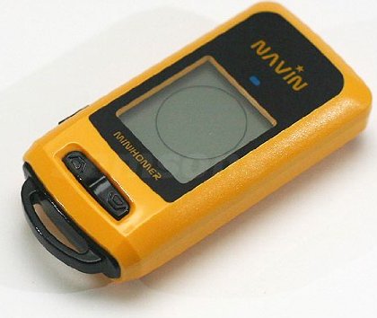
Navin miniHomer Waterproof GPS Position Finder / Data Logger with built-in Compass
Price 69.95 - 74.95 USD
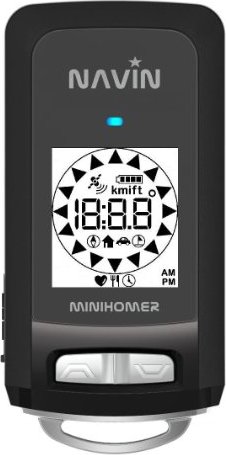
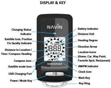
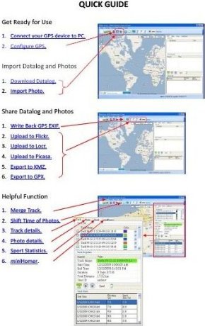
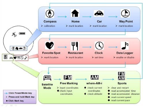
Special version with nTrip software pre-activated firmware. No $5 registration fee needed. New firmware available which adds Lat/Lon Display/Input Extension. Please download New Firmware and apply to the unit to access the new feature. In order to use miniHomer as data logger and to access geo-tag function, please make sure to install nTrip software and USB driver provided below on your computer. * Ever forgot where you parked your car at the mall or stadium? Ever got lost when hiking, biking, or traveling to a new place? miniHomer is a keychain-sized GPS Locator device used for returning to a previously marked outdoor spot. This high-tech, reverse navigation system is low cost, accurate, easy to use, fits in your pocket, and giving peace of mind. * Using latest GPS technology, miniHomer works globally, under all weather condition, 24/7. It is an indispensible tool for outdoor enthusiasts. Whether it is for returning to the camping ground, remembering a favorite fishing spot, or getting back to a place of particular interest you came across during vacation, simply mark the location while you are at the place. Later miniHomer can guide you back to the exact spot no matter how far away you start. * As a GPS Data Logger, the miniHomer is capable recording 165,000 points of position, velocity, and time information. It may be used as trip recorder, giving a complete track / velocity / time history of your travel routes. The logged trip data can be shown on Google Map, or exported to share with friends. For sports application, it can record the path taken and the movement speed for later performance analysis. * As a GPS Guider, ntrip allows users to set miniHomer location icons by manual input of coordinates, or by clicking destination locations on the Google Map graphic user interface. Then miniHomer can guide user with distance and heading information to the target destination. ntrip is also a photo geo-tagging software, facilitating showing of photo on the Google Map at the place where it is taken. It eases users to upload geo-tagged photos to flickr, locr and sharing with friends. The logger data can be exported in KML, KMZ, GPX, CSV, NMEA formats for use with other software.