Croatia Coast 1:200,000 Travel Map, double-sided, FREYTAG, 2012 edition

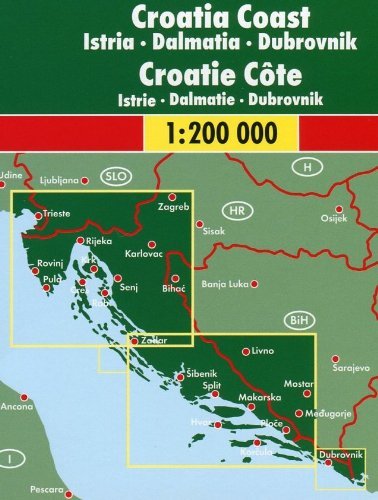
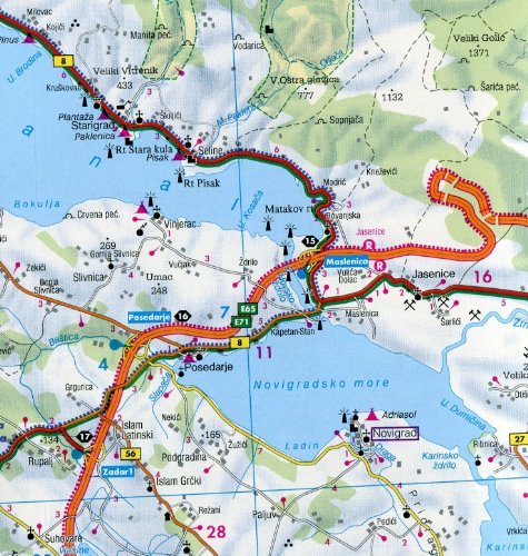
Croatia Coast 1:200,000 Travel Map FREYTAG, 2013 editionTwo-sided, large format (125 x 95 cm / 49 x 37.5 in), detailed road and tourist map covers the Croatian Coast from Molfancone (Italy) to Herceg Novi (Montenegro), including Istria, Dalmatia, and Dubrovnik. The map shows roads, scenic routes, rail lines, distances in kilometers, ports, ferry routes, campgrounds, natural features, places of interest, and tourist sites. Shows coastal islands of Solta, Drevenik Veli, Brac, Hvar, Korcula, Lastovo, Mljet, Vis, Peljesac, Cres, Krk, Rab and Pag. 32-page booklet with place name index. Legend in French, English, German, Dutch, Italian, Spanish, and a few Slavic languages, hard cover.