Ozark National Scenic Riverways, MO Trails Illustrated Map # 260
Price 10.92 USD
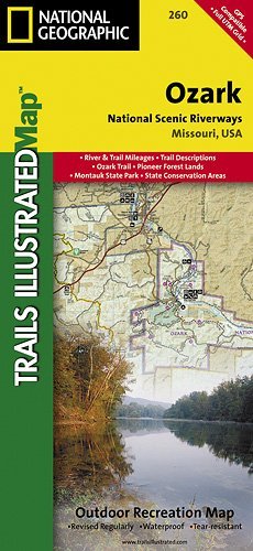
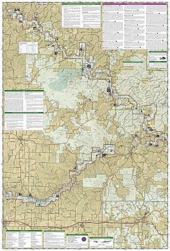
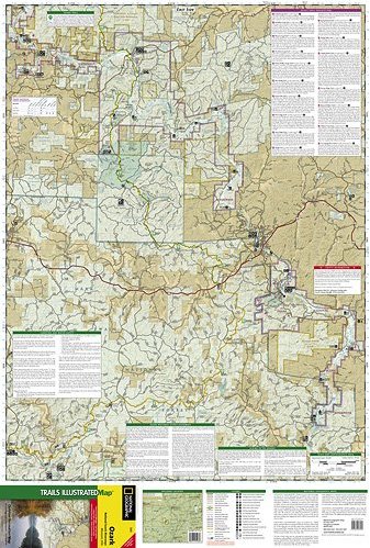
A comprehensive, two-sided topographic map of the Ozark National Scenic Riverways. Includes comprehensive river and trail mileages, campsite and recreational points-of-interest, and trail descriptions for the Ozark Trail, Pioneer Forest Lands, Montauk State Park, and State Conversation Areas. Insets provide information on local hunting, fishing, ATV, equistrian, and spelunking regulations. Printed on 100% plastic material which is waterproof and tear-resistant, ideal for backpacking or river trips. Map includes UTM, Lat/Lon grids, and declination information for use with GPS or compass. Published with the assistance of Eastern National, a nonprofit association that supports Ozark National Scenic Riverway"s interpretive program through the sales of books and other materials. Approximately 4 1/4" x 9 1/4" folded; 27" x 39" fully opened Scale = 1:63,360 Contour Interval = 50 feet Map revised - 2007