Bratislava (Slovakia) 1:16,000 Street Map SHOCART
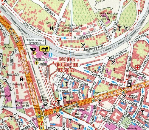
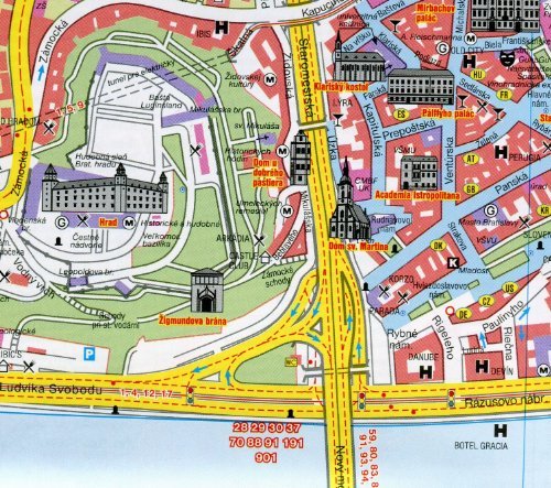
Bratislava (Slovakia) 1:16,000 Street Map by SHOCARTWith the scale of 1:16,000, this folded map covers most of the city including the airport. Colours distinguish public buildings, industrial areas, parks and forests. Detail includes traffic lights, one-way roads, pedestrian zones, car parks, taxi ranks & petrol stations. Railways and tram, trolleybus and bus routes are marked and a range of symbols denote such features as hotels, campsites, hospitals, police, information offices, entertainment venues, monuments, museums, embassies. It includes an inset with a detailed plan of the historical centre 1:8,000 and a diagram of the public transport network 1:45,000 and a 1:200,000 map of the city and wider surroundings. Legend in English, German, Slovak and Czech. Brief multilingual notes are provided for some of the significant historical buildings in the city. Complete street name index. The map si not burdened with hard cover so that it can be easily folded in half and inserted in any of your pockets. Folded size 9x5 inches, made in the Czech Republic.