Allagash Wilderness Waterway South (Trails Illustrated Map # 401) (National Geographic Maps: Trails Illustrated)
Price 10.75 - 11.95 USD
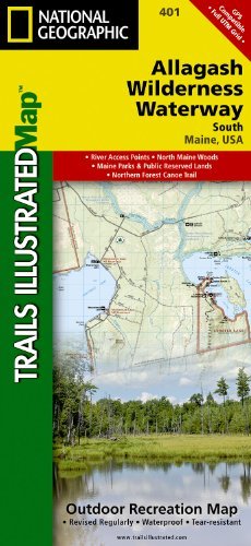
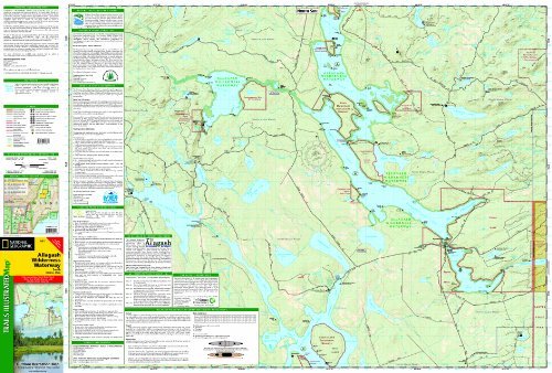
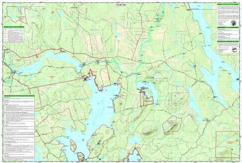
ALLAGASH WILDERNESS WATERWAY SOUTH Trails Illustrated Map National Geographic"s recreational maps (TI 400 and 401) of the Allagash Wilderness Waterway are two- sided, waterproof maps designed to meet the needs of outdoor enthusiasts and tourists alike. Divided into two separate maps for exceptional detail, each is loaded with valuable information such as watercraft regulations, rules for recreational use and access, river difficulty scale, checkpoints, visitor and ranger station locations, and more. A UTM and Latitude/Longitude grid, as well as compass rose and scale bar will keep you pointed in the right direction. Year-round activities abound in the region and the location of scenic viewpoints, wildlife viewing, boat launches and canoe carry downs, lookout towers, amphitheaters, ATV trails, and other points of interest are clearly marked as are park and forest boundaries and access points. Campers will appreciate the attention paid to noting the variety of camping facilities available including primitive campsites, group campsites, rental cabins, RV camping, picnic shelters, restrooms, parking, and trailheads. Whether paddling the Northern Forest Canoe Trail, camping in the North Maine Woods, or driving the Maine Scenic Byway, these maps perform as highly functional travel tools that are as useful as they are remarkably crafted. The front side of the Allagash Wilderness Waterway South map details from the southern portion of Eagle Lake to the northwestern edge of Baxter State Park and the northern reaches of Chesuncook Lake. It includes Allagash Lake, Chamberlain Lake, Caucomgomoc Lake, and dozens of other lakes, ponds, brooks, and streams. Chesuncook Lake continues on the back side of the map with the southernmost section of the waterway which includes Caribou Lake, Ragged Lake, Lobster Lake, Seboomook Lake, and Moosehead Lake. Our Allagash Wilderness Waterway South map is printed in the U.S.A. on durable synthetic paper, making it waterproof, tear-resistant, and trail tough capable of going anywhere you do. The map is two-sided, and can be folded to a packable size of (4.25 x 9.25 ), unfolded size is (26 x 38 ). Net proceeds from the sale of this map go to support the nonprofit mission of the National Geographic Society. Popular Places Included on the Map: Northern Forest Canoe Trail, Eagle Lake, Chesuncook Lake, Gero Island, Bear Mountain, Chamberlain Lake, Allagash Lake, Big Reed Forest Reserve, Caucomgomoc Lake, St. John Pond, Seboomook Lake, Big Spencer Mountain, Moosehead Lake Key Features: Waterproof and tear-resistant Detailed topography and clearly defined, color-coded boundaries of state parks, ecological reserves, easements, and more Helpful information including watercraft regulations, recreational use rules, access points, river difficulty scale, checkpoints, visitor centers, and ranger stations Northern Forest Canoe Trail American Canoe Association safety and trip planning tips Hundreds of points-of-interest, including the location of campsites, scenic viewpoints, wildlife viewing, boat launches, canoe carry downs, lookout towers, and amphitheaters Latitude/Longitude, UTM, and Magnetic Declination for use with GPS and Compass