Korea South & North 1:700,000 Travel Map, waterproof, GPS-compatible, REISE, 2013 edition
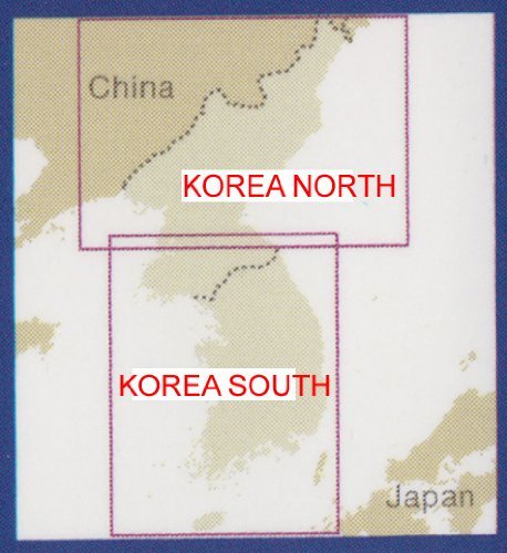
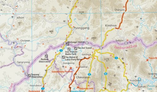
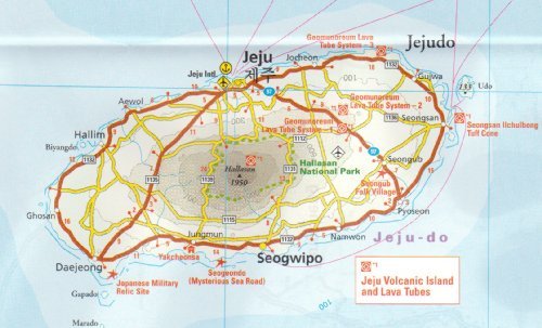
Korea South & North 1:700,000 Travel Map, waterproof, GPS-compatible, REISE, 2013 editionThis map is waterproof and tear-resistant, double-sided to provide the best balance between a good scale and a convenient sheet size (size 100 x 70 cm / 39.5 x 27.5 in) with topographic and tourist information.The map covers the Korean Peninsula, with both North and South Korea (including Jejudo Island). It divides the region north / south, with a generous overlap between the two sides and shows Pyongyang on both sides. A smal inset map shows Ulleungdo Island.Contours, relief shading with spot heights and names of mountain ranges present the topography. Road network shows distances on main routes. Railway lines distinguish standard and high-speed lines. Local airports are included, and ferry links from South Korea to its outlaying islands and Japan are marked. The map also shows internal administrative boundaries in both countries with names of the provinces. National parks or protected areas and numerous other places of interest are highlighted in South Korea. Within North Kore, only World Heritage sites plus a few ancient temples and Communist memorials are marked. Latitude and longitude margin ticks are at 30" intervals. Multilingual legend includes English, the map is indexed and includes a list of national parks. High quality German cartography.