Garmin GPSMAP 696 Color Portable Aviation GPS
Price 1799.00 - 2425.55 USD
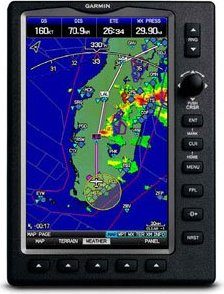
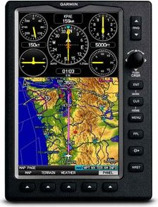
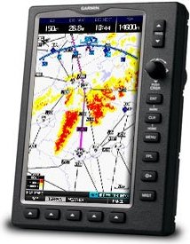
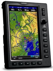
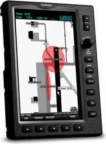
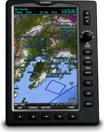
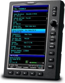
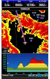
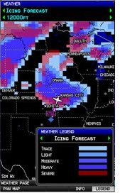
Meet Garmin"s ultimate portable MFD: the GPSMAP 696, an all-in-one navigator designed exclusively for aviation. Featuring a large screen, detailed electronic charts and real-time weather, the 696 is your own personal avionics system. See the Big Picture The GPSMAP 696"s bright 7-inch diagonal high-definition sunlight-readable display makes detailed mapping easy to see day or night you can even view an entire approach plate on the large-format display. For easy operation, the bezel around the screen includes soft keys and a joystick control. And with a fast 5 Hz GPS update rate, the 696 renders graphics and presents flight data smoothly and continuously. No Chart? No Problem. With the addition of Garmin FliteCharts and IFR map mode, the GPSMAP 696 provides key functions of a Class 1/Class 2 electronic flight bag (EFB), reducing the use of paper charts in the cockpit. With FliteCharts, you can quickly find and view all U.S. NACO departure procedures (DP), standard terminal arrival routes (STARs), approach charts and airport diagrams. If the current approach is known, GPSMAP 696 automatically selects the correct chart based on the flight plan. When in IFR map mode, the 696 can display victor airways, jet routes, minimum enroute altitude and leg distance, much like found on paper enroute charts. Add Weather and Radio The GPSMAP 696 includes a GXM 40 smart antenna, which gives you access to high-resolution weather and audio entertainment right in the cockpit (XM subscription required). XM WX Satellite Weather includes next generation radar (NEXRAD), aviation routine weather reports (METARs), terminal aerodrome forecasts (TAFs), temporary flight restrictions (TFRs), lightning, winds aloft and more for the U.S. and Canada. In addition, the 696 can receive PIREPs, turbulence forecast and icing forecast information.