Pyrenees - Andorra - St. Gaudens 1:100,000 Touring Map # 173 IGN
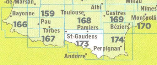
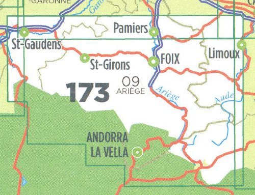
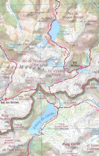
Pyrenees - Andorra - St. Gaudens 1:100,000 Touring Map # 173 IGNMap No. 173, St. Gaudens - Andorra, an exceptionally detailed, contoured touring map, ideal for exploring the Pyrenees by car, by bike, or even on foot. Used by millions of locals and tourists alike, this map provides an excellent balance between coverage of a sufficiently wide area and detailed road presentation, plus topographic information not found on other road maps.This map covers the central part of the Pyrenees, east of St-Gaudens and the upper Valley of the Garonne, including Salies-du-Salat, Le Mas-d"Azil, St-Girons, Foix, Pamiers, Lavalet, Tarascon-sur-Ariège, Mirepoix, Limoux, Odeillo, Ais-les-Thermes, plus most of Andorra, the Spanish enclave of Llivia (Livia), Col de P ymorens, Pic d"Estats and the western part of the Parc Naturel Régional des Pyrénées Catalanes.Included is a plenty of tourist information. For walkers the map has an overprint highlighting long-distance footpaths, the GR routes, making them an ideal supplement to topo-guides. A wide range of symbols mark various places of interest, sport and recreational facilities, mountain refuges, gîtes d"etape, etc. The map carries all the usual information found on topographic maps at this scale: peaks, glaciers, passes, names of mountain ranges and other geographical features, railways with stations, funiculars, ski and chair lifts, administrative boundaries, etc.Presentation of the terrain is sharp to make small local roads clearly stand out. Contours are enhanced by relief shading. Additional colouring shows different types of vegetation or land use. The map has a 5-km UTM grid for GPS users, plus a latitude and longitude grid at 15". Map legend includes English.