Karakoram Highway: 3: With Gilgit City Plan
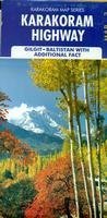
Detailed map of the Karakoram Highway from the Chinese border at the Khunjerab Pass to Sazin where coverage is continued on 65-1361-2 above. There are numerous inset city center maps for Gilgit (1:20,000), Karimabad (1:10,000), evolution of Gilgit town, Hopar Valley (1:250,000), Darel Valley (1:250,000), Ganish town, Chlas town, Khaplu town, Shigar town, Chakuch town, Astore town, Babusar pass & northern valleys (1:250,000), and Kalapani valley (1:250,000). The reverse side also has numerous inset maps of numerous famous hiking/trekking routes, including Minapin trek, Kutwal trek, Karumbar & Chilinji treks, Batura and Passu glaciers treks, Naltar Valley treks, Rupal Valley treks, and several more.