Brittany (Bretagne, France) 1:250,000 Touring Map IGN, 2013 edition
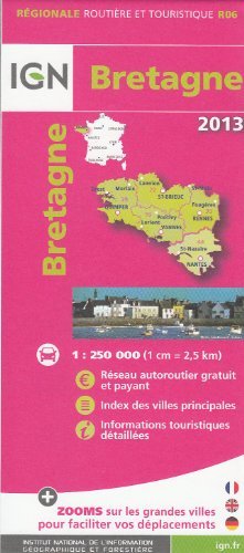
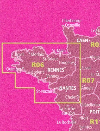
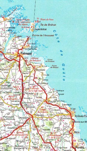
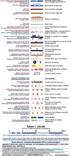
Brittany (Bretagne, France) 1:250,000 Touring Map IGN, 2013 edition High quality road map with tourist information of Brittany at 1:250,000 (1 inch = 3.95 miles). Enlargements show in greater detail road access to Rennes, Brest, St-Brieuc, Quimper, Vannes, Lorient and St-Malo - Dinard.Detailed mapping of regional and minor local roads is combined with very clear presentation of motorways and main national routes, showing toll sections with locations of toll gates, services and rest areas, plus locations of fixed speed cameras. Junction numbers are clearly marked. The map indicates access restrictions, not regularly maintained sections of minor local roads, etc. Intermediate driving distances are marked on main and regional routes. Sections in construction, both on main routes and local roads, are annotated with opening dates. The map also shows the country"s railway network with stations and local stops, as well as departmental and regional administrative boundaries. Towns of particular tourist interest are highlighted and a wide range of symbols mark locations of various places of interest, including chateaux and castles, cathedrals and churches, viewpoints, interesting natural features, nature reserves, etc. National and regional parks are prominently marked. Topography is shown by relief shading with colouring and graphics to indicate wooded areas, marshes, salt marshes, dry or wet sand shoreline, etc. Latitude and longitude lines are drawn at 10" intervals. The index is next to the map and lists main towns in the region. The map is produced and updated by France"s national mapping agency IGN. Map legend includes English.