Lake Placid, High Peaks: Adirondack Park (National Geographic: Trails Illustrated Map #742) NY
Price 10.76 - 11.95 USD
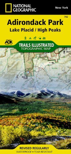

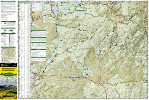
• Waterproof • Tear-Resistant • Topographic Map National Geographic"s Trails Illustrated map of Adirondack Park Lake Placid/High Peaks is a two-sided, waterproof, topographic trail map designed to meet the needs of outdoor enthusiasts with unmatched durability and detail. Discover the Adirondack"s wild, rugged, and beautiful terrain with the map"s detailed elevation contours, shaded relief, vegetation, and water features. This map was created in cooperation with the Adirondack Mountain Club and is loaded with valuable recreation information for all seasons. Trails and major roads are clearly distinguished, along with canoe access and ski areas. Places of interest, including natural features, popular landmarks, and infrastructure are clearly labeled and boundaries for park lands, wilderness, primitive, forest, and protected areas are color coded and easy to discern. Map coverage includes Saranac Lake Islands and Forest, Blue Mountain Wild Forest, High Peaks Wilderness, Vanderwhacker Mountain Wild Forest, Sentinel Range Wilderness, Dix Mountain Wilderness, and Hoffman Notch Wilderness. The east side, bordered by Lake Champlain, shows Clinton State Forest, Jay Mountain Wilderness, Hurricane Mountain Wilderness, and Hammond Pond Wild Forest. The Adirondack Park Lake Placid/High Peaks map is designed and printed in the United States on durable synthetic paper, making it waterproof, tear-resistant, and trail tough – made to head outside and go anywhere you do. The map is two-sided, and is folded to a packable size of 4.25" x 9.25"; unfolded size is 26" x 38". Key Features: • Waterproof and tear-resistant • Updated regularly • Designed and printed in the United States • Detailed road network, including designations for off-highway roads • Clearly marked trails for hiking, canoeing and more • Detailed topography with shaded relief and clearly defined, color-coded boundaries for parks, recreation areas, wilderness areas, forest and primitive areas. • Hundreds of places-of-interest, including campgrounds, information centers, trailheads, viewpoints, boat launches, canoe carry downs, fishing access points, ski areas, rock climbing, museums, lighthouses, and specialty content unique to each area • UTM and Latitude/Longitude coordinate grid, as well as selected waypoints, and a scale bar for easy and accurate navigation. All National Geographic trail maps contain helpful information on local regulations, safety, important contact information, and park interpretive content. Net proceeds from the sale of this map go to support the nonprofit mission of the National Geographic Society.Folded Size = 4.25 x 9.25Sheet Size = 37.75 x 25.5Scale = 1:75,000