Azores (Portugal) 1:50,000 Hiking Map FREYTAG, 2012 edition
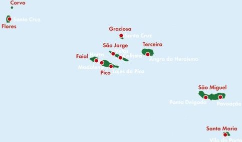
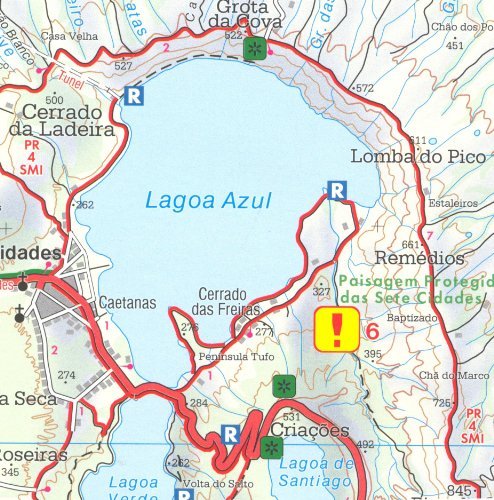
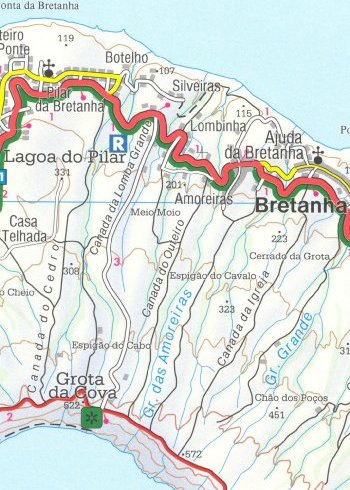

Azores (Portugal) 1:50,000 Hiking Map, 2013 editionThis large format, double-sided hiking / cycling map shows main and minor roads, motorways and toll roads, sections under construction or closed to traffic. Highlighted are scenic routes, gradients on steep roads, driving distances in kilometres, petrol and service stations etc. Railway lines are marked and international and local airports are indicated as well as ferry connections to the other islands. A small inset shows the islands together as a group and ferry and domestic airlines connection within the islands. Relief shading, spot heights and colouring and / or graphics provide a good presentation of the islands topography. Natural reserves are marked and symbols indicate various places of interest and facilities, e.g. museums, churches and castles, viewpoints, beaches, campsites and motels, etc. Latitude and longitude lines are drawn at 2" intervals. The multilingual booklet (English included) contains an index listing all the localities with their postcodes and GPS coordinates and a brief description of main tourist sights.