Salzburg (Austria) 1:15,000 Street Map & Environments, laminated

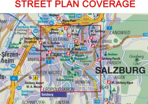
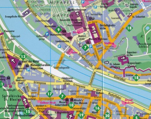
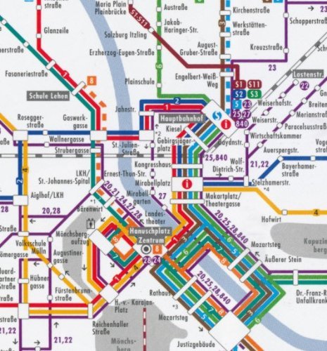
Salzburg (Austria) 1:15,000 Street Map & Environments, laminated This is a laminated, waterproof and tear-resistant map, easy to fold, even in windy conditions, so it can go wherever you go. Size folded: 22 x 10 cm / 8.5 x 4 in, size unfolded: 68 x 44 cm / 27 x 17.5 in.The main plan covers most of Salzburg at 1:15,000, with the city"s historic heart shown on enlargement in greater detail. The plan shows one way streets and car parks. Main public buildings, places of interest and selected hotels are prominently highlighted and named. The plan is indexed for streets, districts, parks, hotels, points of interest and public buildings. Also included is a diagram of the public transport.An indexed touring map of Salzburg"s environs shows the region"s road and rail network and highlights interesting towns, villages and main sights. Additional tourist information mentions major sights with their brief description; the places are prominently highlighted on the relevant maps.Further panels provide information on Getting Around and Facts for Visitors, including tourist information offices, public holidays, festivals and events, telecommunications and monthly climate charts.The map legend and all text is in German only.