Winter Park, Central City, Rollins Pass (National Geographic: Trails Illustrated Map #103) (National Geographic Maps: Trails Illustrated)
Price 10.75 - 11.53 USD

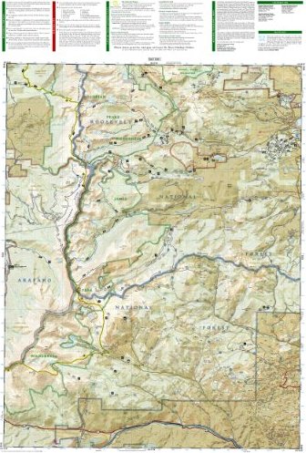
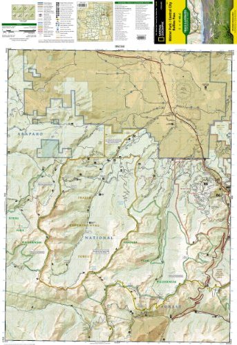
• Waterproof • Tear-Resistant • Topographic Map Coverage includes Roosevelt and Arapaho national forests, Indian Peaks and Byers Peak Wilderness, Eldora, Central City, Empire, Fraser and Winter Park, Berthoud Pass, Fraser River, Clear Creek, St. Mary"s Glacier and Peterson lakes. Also includes Fraser Experimental Forest, and a portion of the Continental Divide Trail. Ski Areas: Eldora, Winter Park and Mary Jane, Devils Thumb cross-country ski area. Includes UTM grids for use with your GPS unit.Folded Size = 4 x 7.5Sheet Size = 22 x 32Scale = 1:40,680