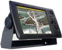
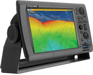
Furuno FUR-MFD12 NavNet-3D 12-Inch Marine GPS Navigator and Chartplotter
Price 3751.40 - 4625.78 USD
The world of onboard navigation systems has evolved, Furunos dedication to deliver the best marine electronics has led to the most innovative powerful solution for onboard navigation ever, Furunos NavNet 3D is a groundbreaking new navigation system that breathes new life into the user interface, Once you start using NavNet 3D you will be amazed at how a system so powerful can be so simple to use, NavNet 3D comes fully loaded with groundbreaking new features that will expand your navigational horizons, NavNet 3D uses a cutting-edge technology weve named ""Time Zero, "" Time Zero facilitates instant chart redraw allowing for zooming in and out changing chart display modes and other chart handling functions seamlessly and with no lag at all, Time Zero brings you a truly seamless navigation environment you have to experience to believe, True 3D environment for a more instinctive chart presentation, NavNet 3D incorporates a whole new dimension into chart presentation with Full Time 3D chart rendering, You can choose a 2D top-down view of the navigation chart for a look and feel that duplicates a traditional chart plotting presentation, Or you can choose to pan and zoom the chart to any angle at any range scale you choose instantly, There is no 3D mode to change into and no waiting at all because NavNet 3D operates in this 3D environment full time, This variety of chart presentations helps to improve your situational awareness by giving you unprecedented control over your charting environment, NavNet 3Ds powerful new graphic engine brings new chart presentation options to the conventional 2D method of chart plotting, Satellite Photo Fusion is a powerful new tool a hybrid blend of detailed satellite imagery and critical chart data, These new presentation options allow you to visually grasp your exact position in a way that was never before possible, NavNet 3D incorporates native 3D chart architecture that allows for a full-time 3-dimensional presentation as opposed to 2D charts that require special effects to appear 3D, There are no special modes; that limit your ability to navigate the way you want, With NavNet 3Ds true 3D environment you can see all of the information you want with no limitations on what information you wish to view, Plan your routes and enter waypoints directly on your raster or vector native 3D charts, Radar overlay Sirius Network Weather Receiver AIS plus all of your chart symbols and depth soundings; any and all of this information can be displayed at will, This is the beauty of navigating in true 3D, You have full control over the presentation all of the time, Satellite Photo Fusion, Satellite photography can be fused with raster or vector chart information, Land areas (zero depth) are completely opaque so that these areas are displayed as satellite photos on the chart, As the depth increases the satellite photography becomes more transparent so that you will know where the shallows end and the deeper water starts, High resolution satellite photography aids in seabed classification so that you will be able to easily identify areas of sand rock coral or other obstructions, Time Zero Technology Makes Chart Redraw A Thing Of The Past High-speed processing and a powerful graphic engine deliver Time Zero technology instant seamless chart handling with no lag or loading time, NavNet 3D Time Zero technology redefines the meaning of stress-free operation, Zoom seamlessly and continuously to whatever chart scale you desire, Instead of limiting you to a small handful of chart scales to choose from Time Zero architecture allows you to zoom in or out to the exact magnification level you like without steps or limitations, You can freely pan and scroll the chart by simply pressing the scroll pad, This gives you freedom to explore the chart data allowing you to focus on a specific area ahead of or around your vessel without losing track of your position on the chart, Explore the chart data at