2012 Collins Britain Road Map (International Road Atlases)
Price 4.68 - 7.95 USD
book24.ru4.68 USD
EAN/UPC/ISBN Code
9780007427406
Producer
An Imprint HarperCollins Publishers
Weight
125 gr
Year of production
2012
Binding
135x240
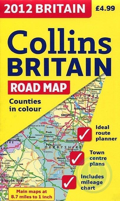
Full color double-sided map of Great Britain at 9 miles to 1 inch with clear, detailed road network and administrative areas shown in color A general purpose map for business users and tourists, this popular map is useful for reference or route planning, with a particular emphasis on political features. It has clear political coloring with counties and unitary authorities shown in color as well as showing a detailed road network. It includes 16 city/town center street plans, a place name index to place names, a mileage chart, and a key in English, French, and German. Northern England and Scotland are on one side with Southern England and Wales on the other.