The Complete Earth: A Satellite Portrait of Our Planet
Цена 30.62 - 44.94 USD
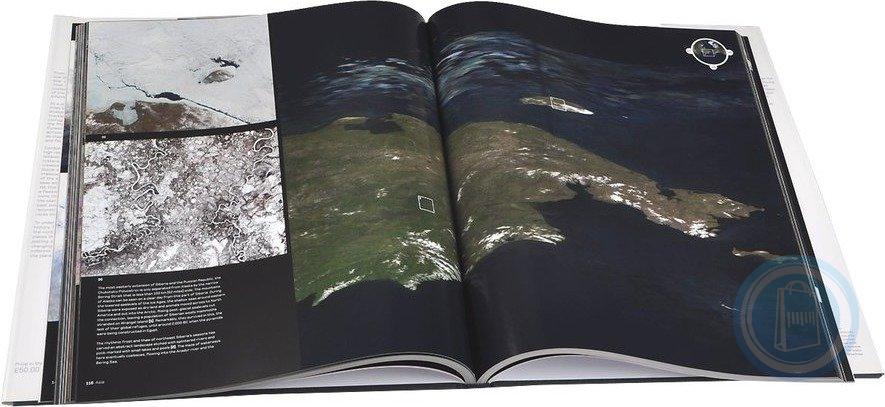
Data from NASA"s most advanced Earth satellites has been combined to create the most detailed global portrait of our planet ever created - here this photomap is reproduced in its astonishing entirety, at full-resolution. Living up to its title, this glorious tome reveals the whole planet, pole to pole, cloud-free, at a resolution of 500 miles to every pixel, or 90 miles to every inch. At this scale, we can trace the Amazon from Andean headwaters to Atlantic mouth, explore the trackless sand seas of the Sahara, or follow the corrugated ridges of hills and mountains that mark the frontline of India"s tectonic assault on Eurasia as if we were in low-Earth orbit. These images are supplemented by a wealth of even higher resolution satellite imagery that zooms in on noteworthy features - from volcanoes to cities, river deltas to glaciers. In addition, 12 double-page-spreads chart one year in the life of our planet as they follow the ebb and flow of the seasons across the globe: we...